Hazardous Weather Outlook
Page: 2

Showers and thunderstorms will (hopefully) bring much-needed relief to the Bighorn Basin while temperatures will drop over 30 degrees overnight. Cody, Worland, and the entire Bighorn Basin will experience a week of wild weather. As a result, residents should prepare for anything and everything over the next few days. According to the National Weather Service…
After so much heat and so little water, Bighorn Basin residents should brace for a new onslaught of weather this week – monsoons and flash floods. With drought conditions persisting throughout Wyoming, the Bighorn Basin will be getting a reprieve this week. But, unfortunately, forecasts suggest it might be too much of a good thing.…
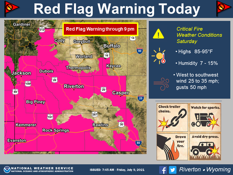
Several factors are contributing to the hazardous atmosphere surrounding Cody, which means residents need to be extra careful to stay safe and avoid wildfires. The National Weather Service (N.W.S) has two Hazardous Weather Outlooks in effect for Cody and northwest Wyoming on Friday, July 9. Normal summer conditions mix with abnormal phenomena in the current…
Expect wind gusts as high as 80 mph in some parts of Park County, starting Sunday night and blowing all day Monday. The National Weather Service has issued a Hazardous Weather Outlook for western and central Wyoming, including all of Park County, effective at midnight Monday. It continues until at least 6 p.m. Cody residents…