National Weather Service Anticipates a Warmer, Drier October for Wyoming
Written by Andrew-Rossi on September 23, 2022
The National Weather Service is predicting October – and the last three months of 2022 – will bring above-average temperatures and below-average precipitation for Wyoming.
The National Weather Service Office in Riverton released the latest report from the agency’s Climate Prediction Center. According to the report, October 2022 looks more like summer than fall.
Almost the entire continental United States will experience above-average temperatures throughout October. Furthermore, higher temperatures mean lower precipitation for the Great Plains region and Wyoming.
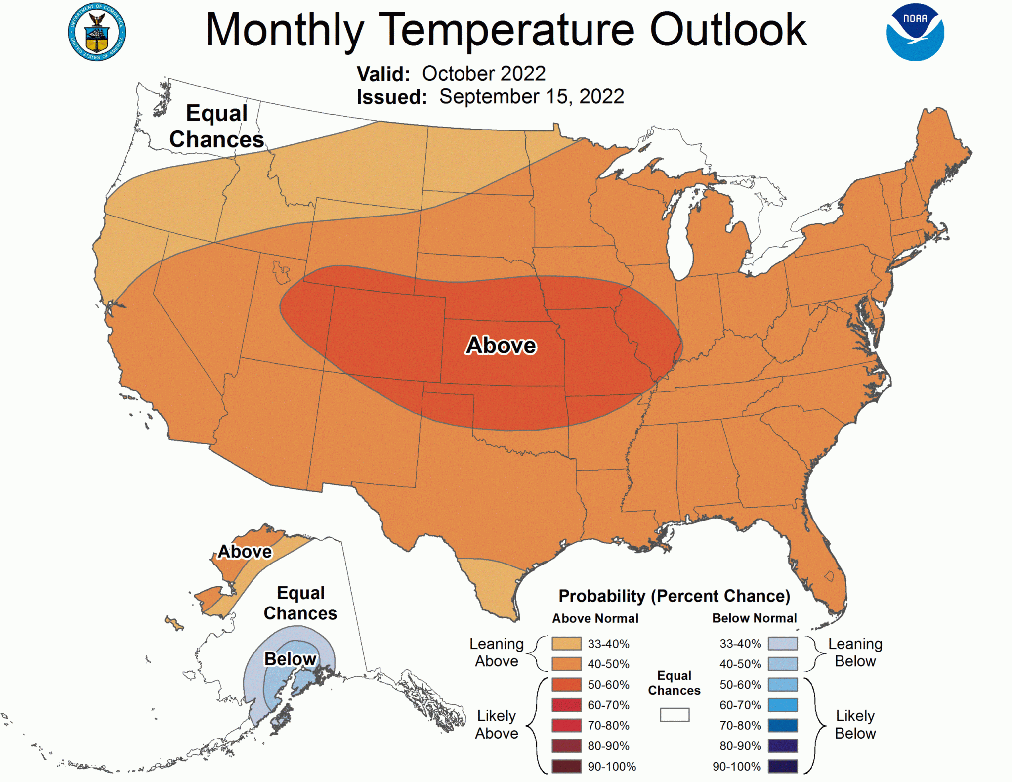
Courtesy National Weather Service
Climatic predictions show temperatures in Wyoming will be between 30% and 60% warmer than usual in October.
Temperature ranges vary across the state. However, the general pattern is the further south you go, the warmer the month is expected to be.
Unfortunately, higher temperatures mean drier weather. As a result, the Climate Prediction Center anticipates 30% to 40% less precipitation in the far north (including Yellowstone National Park and the Bighorn Basin.)
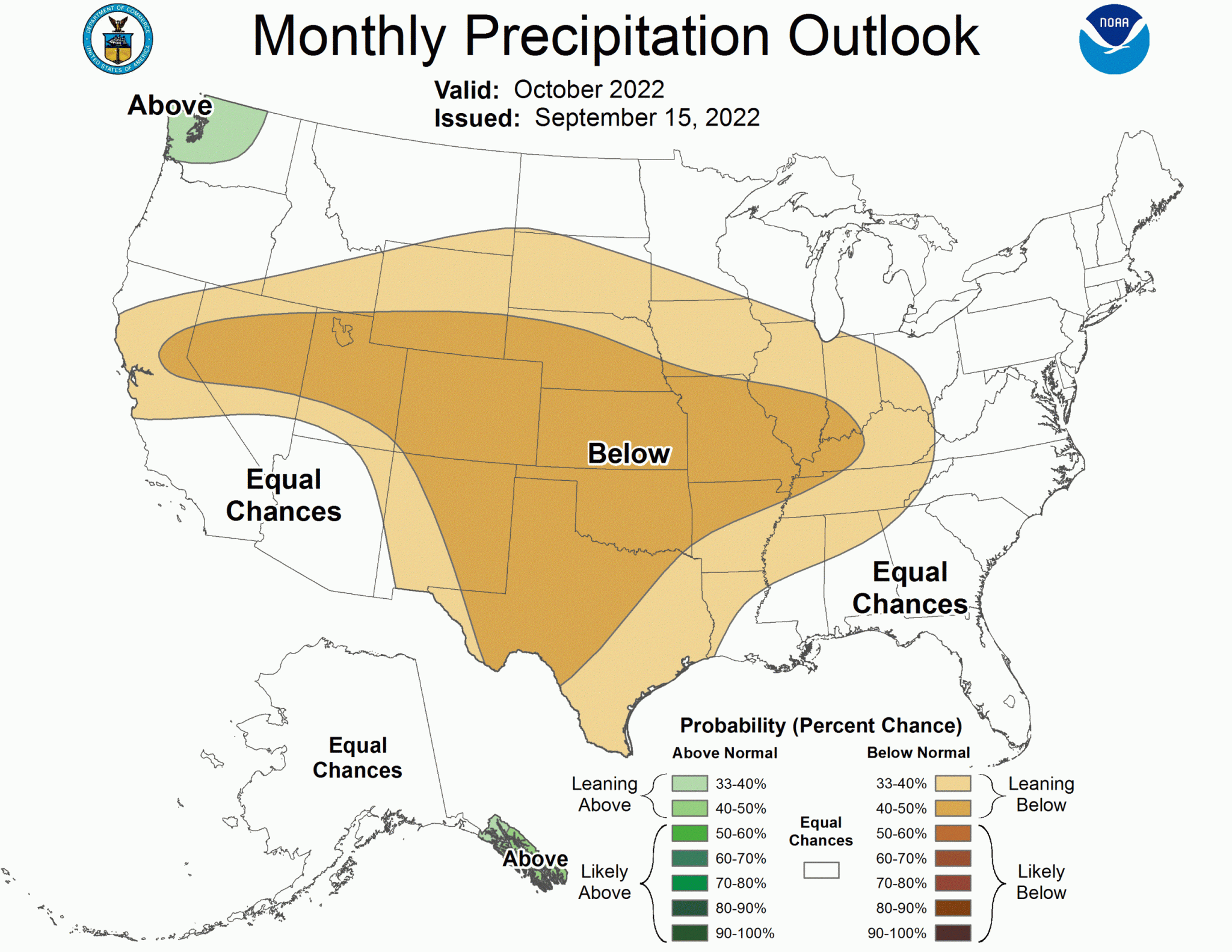
Southern Wyoming is expected to see 40-50% less precipitation throughout October 2022.
The Climate Prediction Center also has a Three-Month Outlook for the United States. That forecast is slightly better – above-average temperatures and either average or below-average precipitation for October, November, and December.
However, the good news is that this pattern shouldn’t persist for the winter season. At least in the Bighorn Basin, weather will get wintery in 2023.
The Old Farmer’s Almanac predicts a colder, snowier winter for Wyoming. And that prediction doesn’t conflict with the Climate Prediction Center’s, as most of the winter weather is expected from late December thru early March.
Based on regional maps, the Bighorn Basin is right on the line between an above-average or below-average season of snow.
The forecast for the Texas-Oklahoma region is a colder than normal winter, “with the coldest periods in early to mid-January and early to mid-February.” However, precipitation will be below average, with the best chances for snow in mid-to-late January and early February.
Incidentally, the High Plains region is also forecast to have a colder than normal winter. The coldest periods will be late November, early December, early January, and early and late February.
However, precipitation and snowfall will be above normal in the north and below normal in the south. The snowiest periods will be mid-to-late November, mid-to-late January, and early February.
Luckily, there is one caveat. While the Texas-Oklahoma region is forecast to have less snow overall, “snowfall will be above average in the north.” That, it seems, balances everything out.
A likely interpretation of the confusing regional forecasts is the Bighorn Basin will experience a colder-than-average winter with average – possibly above-average – snowfall.
Bighorn Basin’s Winter Forecast is Colder than Normal – But What About Snow?