Breaking News: Cody, Park County, & Yellowstone National Park Under Flash Flood Warning
Written by Andrew-Rossi on June 13, 2022
Most of Northwest Wyoming – including Park County and Yellowstone National Park – is under a Flash Flood Warning until 1 p.m. Monday afternoon.
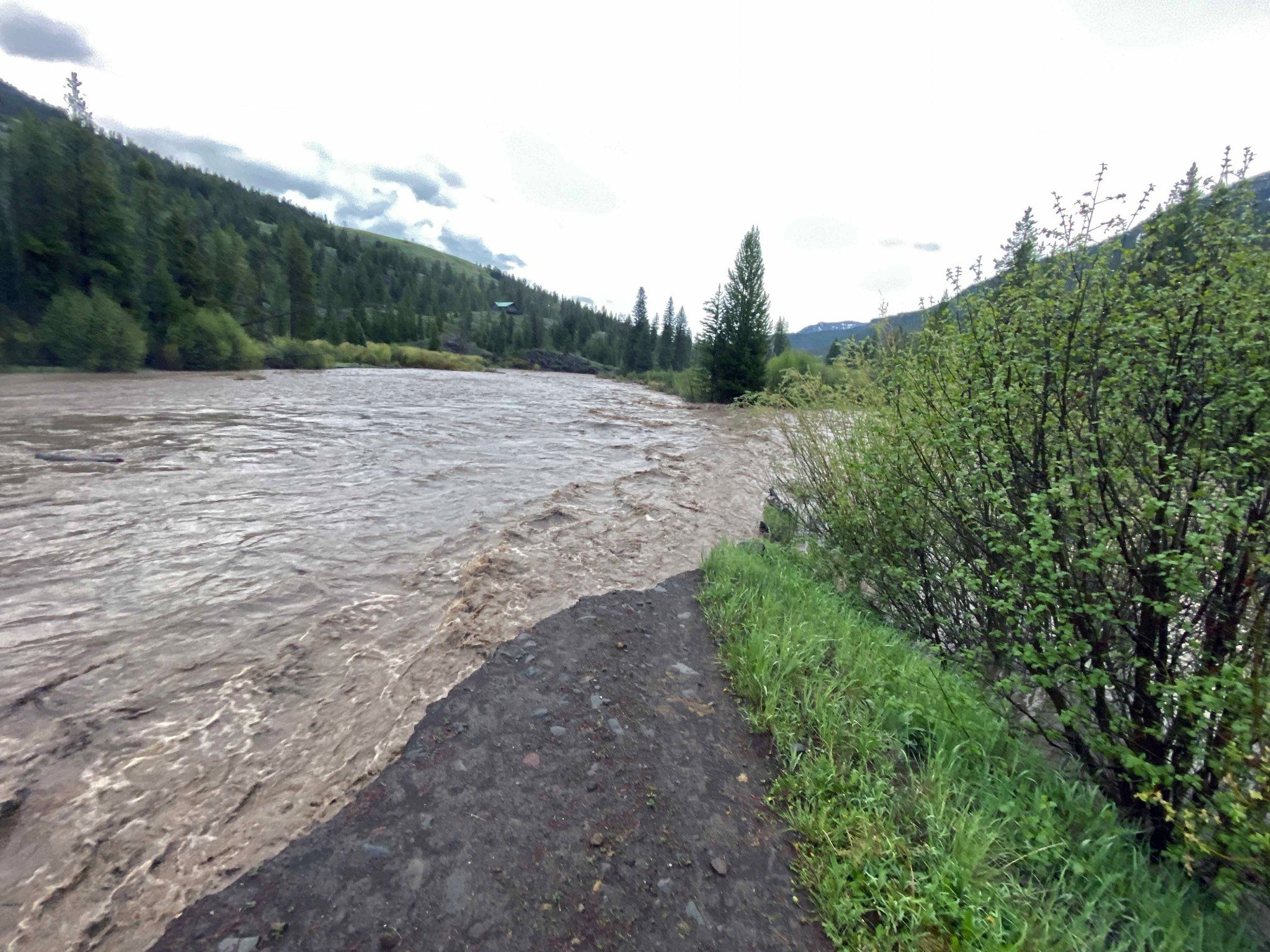
The National Weather Service Office in Riverton issued a Flash Flood Warning and Advisory for northwest Wyoming. According to the N.W.S., record temperatures and rain showers are creating hazardous conditions around the region’s rivers and streams.
Near-record temperatures Sunday caused more high elevation snowmelt, and this water will make its way through area streams and rivers overnight and into the day Monday. Additionally, rain showers will move across the state Monday, adding water to already high rivers. Expect streams and rivers to run high and fast over the next several days. It is likely most small streams and creeks, and possibly some main stem rivers will reach their highest levels of this snowmelt season by the early to middle part of this week.
People along small streams that have been impacted by spring snowmelt floods in the past should be prepared for water rises tonight through the middle of this week.
Remember, during active snowmelt runoff, mountain and foothill creeks flow highest from late evening through early morning, as water from melted high elevation snow takes several hours to flow downhill. Those recreating outdoors should stay away from these cold, fast-moving streams and avoid camping near any waterway. Do not attempt to cross a creek or stream on foot as the power of the water can easily carry you downstream.
The Flash Flood Warning is in effect until 1 p.m. Monday afternoon. The Advisory is in effect until 10 p.m. Monday.
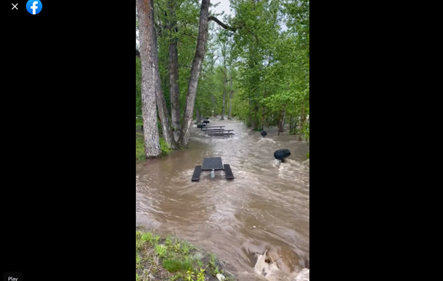
Flooding is already being reported. Pahaska Tepee, near the East Entrance of Yellowstone National Park, closed its restaurant, lodging, and public restrooms due to flash flooding.
Courtesy Pahaska Teepee
Weather forecasts for Cody over the next two days show more precipitation falling, contributing to the already high volume of water flowing through Park County.
Today (June 13)
- Isolated showers, then scattered showers and thunderstorms after noon. Mostly cloudy, with a high near 69. Breezy, with a west southwest wind 15 to 21 mph, with gusts as high as 31 mph. Chance of precipitation is 30%.
Tonight
- Scattered showers and thunderstorms. Partly cloudy, with a low around 41. Breezy, with a west wind of 13 to 20 mph, with gusts as high as 30 mph. Chance of precipitation is 30%.
Tuesday (June 14)
- Isolated showers and thunderstorms after noon. Mostly sunny, with a high near 63. Windy, with a west wind of 13 to 18 mph increasing to 20 to 25 mph in the afternoon. Winds could gust as high as 38 mph. Chance of precipitation is 20%.
Tuesday Night
- Partly cloudy, with a low around 43. Windy, with a west southwest wind of 15 to 25 mph, with gusts as high as 38 mph.