Significant Winter Storm Burying Bighorn Basin This Weekend
Written by Andrew-Rossi on April 22, 2022
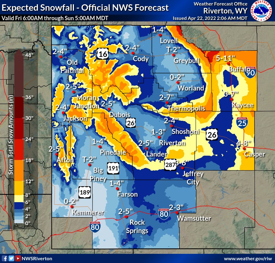
A massive winter storm is heading for Wyoming, which will bring significant snow and dangerous winds all day Saturday, with the biggest impacts in the Bighorn Basin.
The National Weather Service Office in Riverton is anticipating an intense late-season winter storm rolling into Wyoming on Friday night, all day Saturday, and possibly Sunday morning. While the entire state will feel the effects, the “greatest impacts” will be in the Bighorn Basin.
A Hazardous Weather Outlook for “significant snow in central and northern Wyoming” was issued Friday morning. Meanwhile, the entire Bighorn Basin – Cody, Clark, and Meeteetse in particular – is already under a Winter Weather Advisory from 9 p.m. Friday until 6 p.m. Saturday.

Courtesy US National Weather Service Office Riverton
Park County’s forecast calls for heavy snow – with two to five inches of accumulation – and winds as high as 50 mph.
The NWS cautions Wyomingites that travel could be difficult at times, with blowing snow visibility around only a tenth of a mile. In addition, roads are expected to be slick and wet by Saturday afternoon.
Furthermore, the high winds – coupled with wet snow and cold temperatures – could harm young livestock.
Courtesy NWS Office Riverton
However, this will be a fleeting – and possibly the final – assault of winter as weather and temperatures will “spring” back to expected April conditions by Sunday.
Cody’s Sunday forecast calls for sunny skies and a high temperature of 61 degrees.
You can watch an in-depth breakdown of this weekend’s winter storm on the W.Y.D.O.T. Videos YouTube channel.